Bo Yang: Cultivating the Next Generation of Environmental Scientists

“First, we introduced them to how high-resolution drone mapping can be used in societal and environmental science applications,” said Yang. “In the second half of the course, students gained hands-on experience in flying drones under FAA part 107 regulations, autonomous route planning and field safety.”
One of the ways the MSTI engaged students was to provide exposure to technology and innovations, such as drones, used in the transportation industry, as well as help them understand the impact transportation has on the environment.
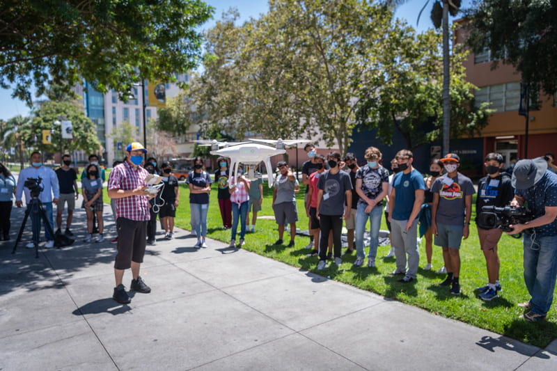
Yang instructs local high school students how to fly small and large drones during the MSTI at SJSU. Photo: Robert C. Bain.
“The students learned that drones are not only used for photography — but they can also be used to do amazing science combined with geo-spatial technologies and Geographical Information Systems (GIS),” explained Yang.
He said he hopes the training “initiated the students’ interest in transportation and environmental science,” given the potential for them to incorporate drones in their future studies.
Yang is no stranger to mentoring up-and-coming scientists. He worked in K-12 and higher education, and mentored both undergraduate and graduate students through NSF projects, collaborating with Smithsonian MarineGEO, Cornell, UC Davis, Oregon State, and UCF, among others.
He also has overseen multiple participatory GIS projects with students, including this year, when Yang led a group of SJSU urban planning and geography students on a trip along the west coast collecting drone and GIS data to monitor coastal seagrass habitats.
In addition, Yang’s research focus in spatial data science in GIS and remote sensing played a key role in his recent paper “Traffic restrictions during the 2008 Olympic Games reduced urban heat intensity and extent in Beijing,” which was published in Nature – Communications Earth & Environment earlier this year.
His study contributes important research findings to environmental science about how reduced traffic volumes and heat exhaust can lower urban surface temperatures and the heat island effect.